National Weather Service has provided detailed information on the EF-1 tornado that touched down in Mahanoy City on Monday night.
The tornado, which had peak wind speeds of approximately 90 mph, caused considerable damage around the borough. Luckily, no injuries have been reported.
Mahanoy City Tornado Details
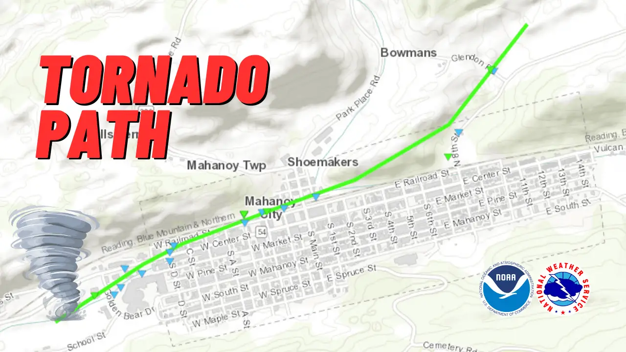
The tornado originated just west of Mahanoy City at approximately 7:38 p.m. and followed a northeast path.
During its brief existence, the tornado traveled 1.5 miles and had a maximum width of 75 yards. It lasted for about six minutes, lifting at 7:44 p.m. after crossing Glendon Road.

Significant damage was reported along the tornado’s path. Numerous trees were uprooted, and several houses sustained damage to their roofs and siding.
Pieces of wooden debris were tossed into the air, with some resulting in impalements into rooftops.
Mahanoy Area Elementary School also suffered from several broken windows. Electricity was restored to this school on Tuesday evening, according to an update from Mahanoy Area Superintendent Joie Green.
| Mahanoy City Tornado By the Numbers | |
|---|---|
| Rating | EF-1 |
| Estimated Peak Wind | 90 mph |
| Path Length | 1.5 miles |
| Path Width | 75 yards |
| Fatalities | 0 |
| Injuries | 0 |
| Start Date | May 27, 2024 |
| Start Time | 7:38 PM EDT |
| Start Location | 1 W Mahanoy City |
| End Date | May 27, 2024 |
| End Time | 7:44 PM EDT |
| End Location | Mahanoy City |
Subscribe to Coal Region Canary
Get email updates from Coal Region Canary by becoming a subscriber today. Just enter your email address below to get started!Support Coal Region Canary
Like our reporting and want to support truly local news in Schuylkill County? Your small donations help. For as little as $5, your contribution will allow us to cover more news that directly affects you. Consider donating today by hitting the big yellow button below ...


