


Exactly how much snow will fall on Schuylkill County from the impending snowstorm remains a bit of a mystery.
Some weather models are showing the heaviest snow totals – even the one that showed a big storm hitting us all week – off to our east.
But there are others that have Schuylkill County in line for its second whopper of this winter season.
As always, we’ll show you what is being forecast for this storm, including our first round of town-by-town snow totals from National Weather Service, and update accordingly as we get closer to its arrival.
Weather Models Still All Over the Place
Usually, so close to the start of a storm, weather models seem to come together and show a similar story.
For you unity fans, that’s not happening right now.
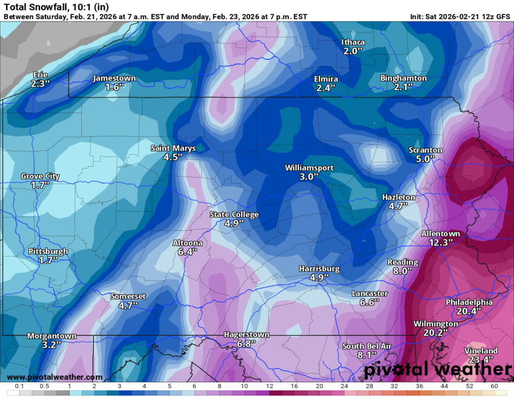
Here’s a look at what the more popular weather models are showing as far as snow intensity from this storm.
Remember, as weather people who insist they’re always right will remind you, these model maps shouldn’t be used to determine how much snow will fall (until they say so) but more so to tell you if you’re getting a lot of snow, a moderate amount of snow, or no snow at all.
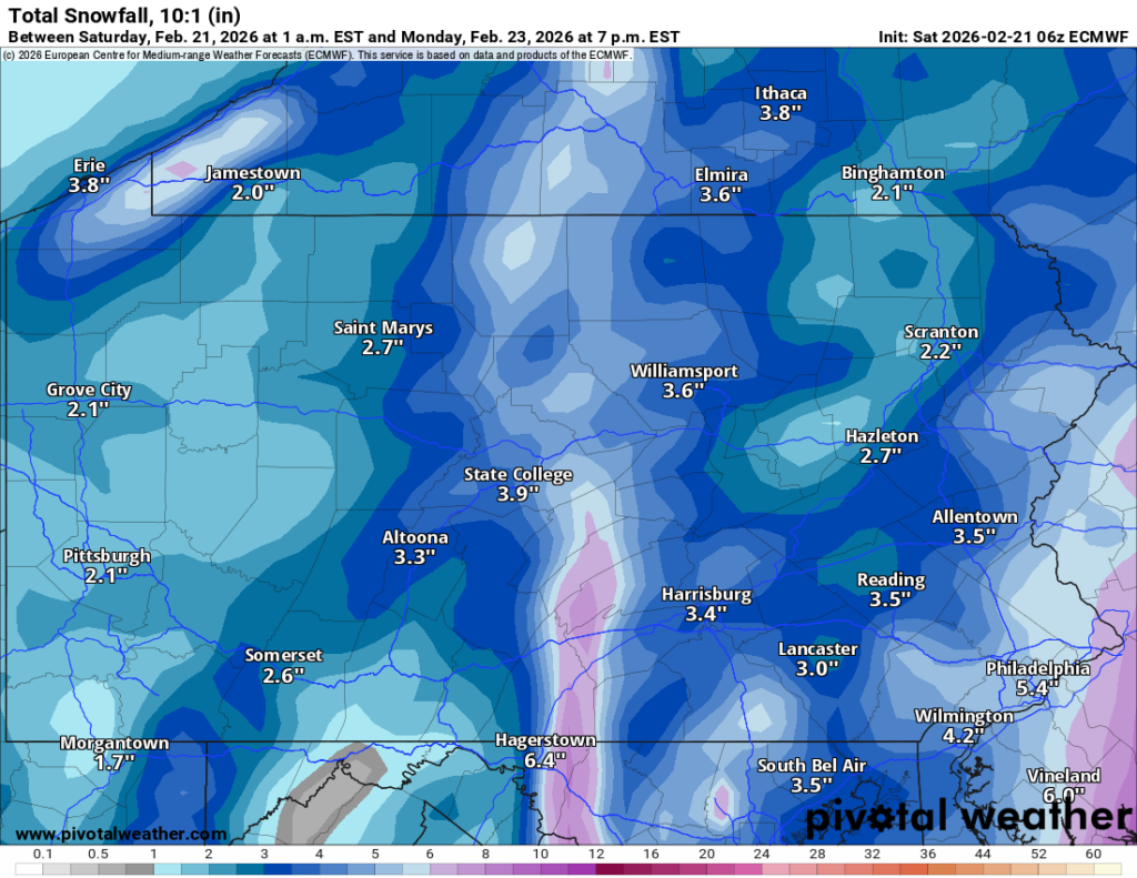
American
The model that showed a real blast of snow for Schuylkill County all week has backed off quite a bit now, withe heaviest totals to our east.
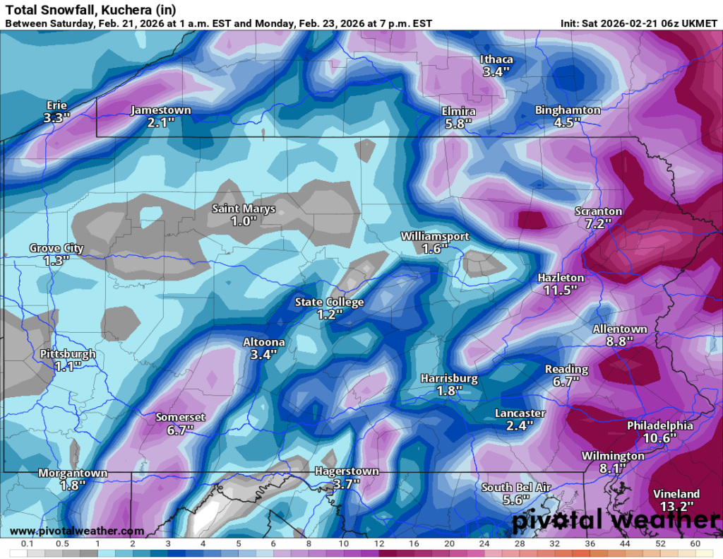
Euro
The Euro model is also showing a rather tame snowstorm for us here in the coal region. But it’s been like that much of this week.
UK
The UK model shows all but southern Schuylkill County getting a significant storm.
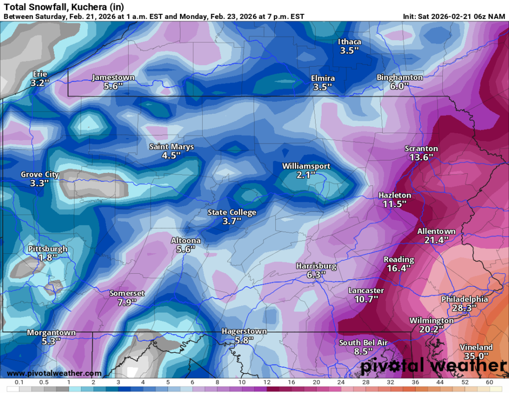
NAM
This short-range model has Schuylkill County getting blasted with snow, with really heavy snow just to our east.
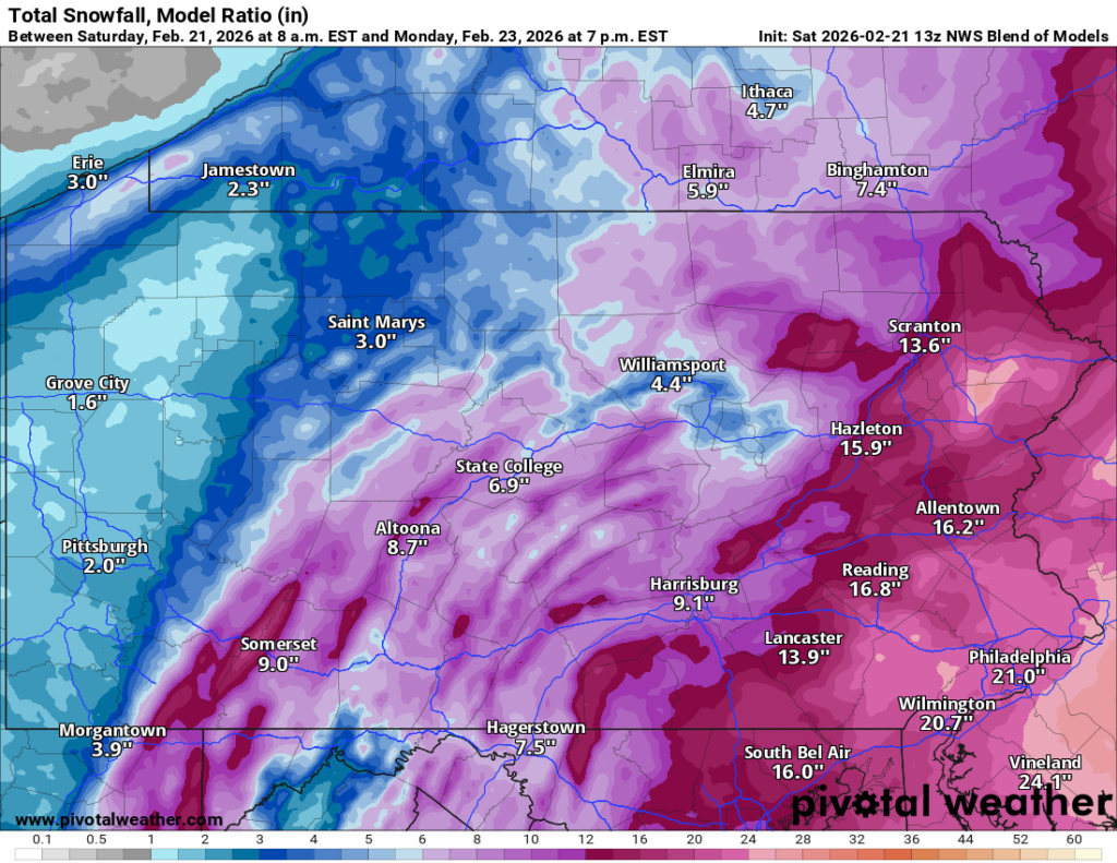
NWS Blend of Models
The National Weather Service Blend of Models seems to be taking into consideration the models that have a more significant storm hitting the coal region. Here is its latest run:
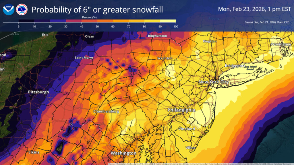
National Weather Service Forecast
A Winter Storm Watch is in effect for Schuylkill County. It goes into effect tonight and extends through Monday afternoon.
This latest map from NWS seems to favor a heavier storm for Schuylkill County, with a likelihood that much of the area will receive at least 6 inches of snow from this impending storm.
Latest Snow Totals for Schuylkill County on Feb. 22-23
Here are the latest snow totals forecast by National Weather Service for numerous locations around Schuylkill County (as of 12:30 p.m. Saturday).
Totals are based on the information included in 7-day forecasts for each area and were last updated by NWS just after noon on Saturday:
| Location | Snow + Sleet |
|---|---|
| Andreas | 5-13″ |
| Ashland | 4-8″ |
| Auburn | 5-10″ |
| Barnesville | 5-11″ |
| Cressona | 4-6″ |
| Deer Lake | 4-7″ |
| Delano | 6-12″ |
| Deturksville | 4-7″ |
| Frackville | 6-10″ |
| Friedensburg | 4-7″ |
| Gilberton | 5-9″ |
| Girardville | 5-9″ |
| Good Spring | 4-8″ |
| Gordon | 4-7″ |
| Hegins | 4-7″ |
| Klingerstown | 3-5″ |
| Lake Wynonah | 4-6″ |
| Landingville | 4-7″ |
| Lavelle | 4-7″ |
| Mahanoy City | 6-10″ |
| McAdoo | 6-12″ |
| Middleport | 4-7″ |
| Minersville | 4-7″ |
| Muir | 4-7″ |
| New Philadelphia | 4-7″ |
| New Ringgold | 5-13″ |
| Orwigsburg | 4-7″ |
| Palo Alto | 4-7″ |
| Pine Grove | 4-6″ |
| Pitman | 3-6″ |
| Port Carbon | 4-7″ |
| Port Clinton | 5-11″ |
| Pottsville | 4-7″ |
| Ravine | 4-6″ |
| Ringtown | 4-7″ |
| Rock | 4-6″ |
| Sacramento | 4-7″ |
| Saint Clair | 4-7″ |
| Schuylkill Haven | 4-7″ |
| Shenandoah | 5-9″ |
| Sheppton | 5-9″ |
| South Tamaqua | 5-13″ |
| Suedberg | 4-6″ |
| Tamaqua | 5-11″ |
| Tower City | 4-7″ |
| Tremont | 4-7″ |
| Zion Grove | 4-6″ |
Jessica Pretti
February 21, 2026 at 12:53 pm
Spell check is a great tool to utilize, spelling mistakes are truly third grade.