


It’s now pretty much a certainty that a major winter storm will impact Schuylkill County this weekend.
National Weather Service says in its latest update that the likelihood of double-digit snowfall accumulation totals is very high.
Snow will be falling at rates of more than an inch per hour on Sunday in Schuylkill County.
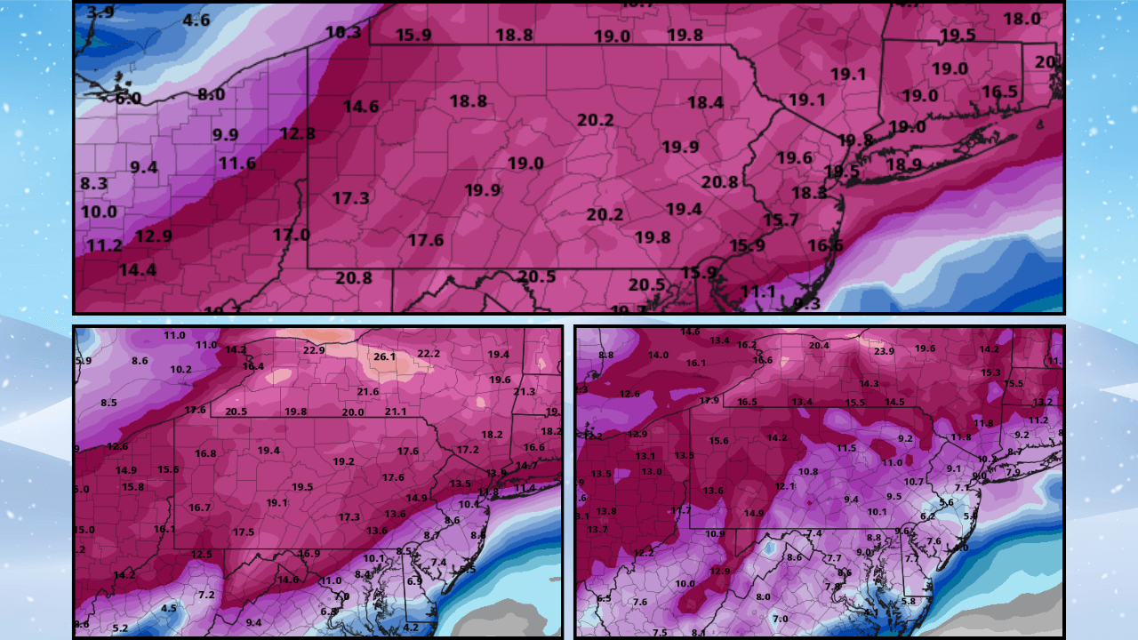
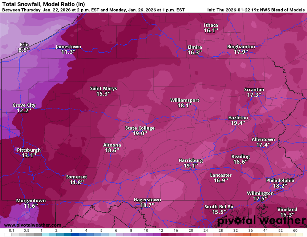
The latest National Weather Service Blend of Models has up to 19 inches of snow falling on Schuylkill County for the duration of the upcoming winter storm.
Snow Emergencies Already Declared in Some Parts of Schuylkill County
Some municipalities aren’t wasting time in issuing their version of a Snow Emergency.
Alerts began trickling in here to the newsroom on Thursday as boroughs look to get vehicles off Snow Emergency Routes and out of the way of snow removal efforts.
For the latest Schuylkill County snowstorm alerts, check out our new STORM CENTER post by following the link below:
STORM CENTER: Schuylkill County Winter Storm Alerts
We expect more alerts and emergency declarations to be issued on Friday.
Models Agree on Significant Snowfall in Schuylkill County
Weather models show that a major storm is a near certainty at this point.
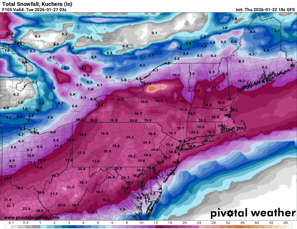
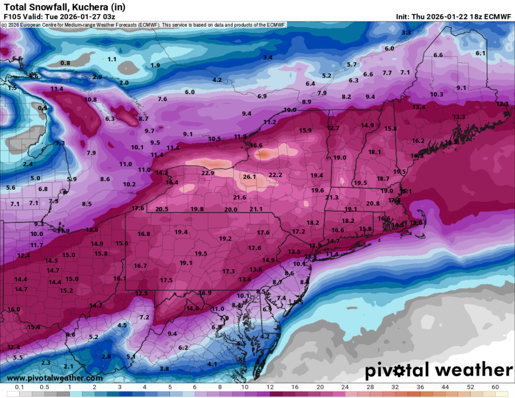
We were told that relying on the traditional 10:1 ratio for predicting snow totals may not be the most accurate since a light, fluffy snow is expected with this storm. So, we’re now sharing images of model runs with the Kuchera ratio factored.
Using that ratio, you can see below that both the American and European models are showing a real whopper of a storm for Schuylkill County, with the potential for 20 inches of snow.
Of course, these numbers can and likely will change before Saturday night.
GFS (American)
ECMWF (Euro)
Bitter Cold
In addition to the massive snowfall predicted, bitter cold air will move into Schuylkill County starting Friday afternoon.
National Weather Service has issued a Cold Weather Advisory for Friday night into Saturday morning, ahead of the snowstorm.
Wind chill values are expected to drop to -10 overnight into Saturday. The actual low temperature on Friday night is forecast at 4 degrees.
Steady winds all day Friday of 6-11 mph could gust up to 30 mph. Wind gusts persist into early Saturday.
The wind will calm down a bit over the weekend, during the storm, but temperatures will stay well below the freezing mark, including during the day.
The forecast high temp on Saturday is just 16 degrees with a low of 9 degrees.
On Sunday, the high temp will be 18 degrees with a low of 15 degrees.
Temperatures are not expected to get much higher than 20 degrees through at least Thursday next week. Low temps each night between Sunday and Wednesday won’t get above 10 degrees.