


Another nuisance variety snowstorm is set to drop up to 2 inches of fresh powder over Schuylkill County late Wednesday and into Thursday morning.
This would make the third such storm this week after about an inch or two fell on Sunday morning and then another 2-3 inches piled up across Schuylkill County on Tuesday morning.
Snow Expected in Schuylkill County Late Wednesday-Early Thursday
Here’s a look at the short-range snowfall maps from the leading weather models:
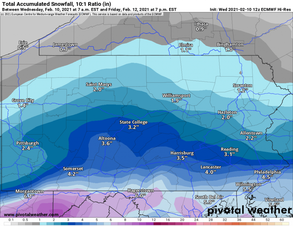
Euro Snowfall Map – Wednesday, Feb. 10-Thursday, Feb. 11
While both the Euro and GFS models vary slightly in the amount of snow expected in Schuylkill County. They do seem to be in agreement on the timing of the snow, starting late Wednesday night or early Thursday morning.

GFS Snowfall Map – Wednesday, Feb. 10-Thursday, Feb. 11
Snow is expected to move out of the area rather quickly and should be wrapped up by the morning commute time, if these models are to be believed. It still could create some delays on Thursday morning.

National Weather Service – Hazardous Weather Outlook
In a Hazardous Weather Outlook from National Weather Service on Wednesday, the area may only see a coating to about an inch of snow in some spots. Snow should last between 4-6 hours and be wrapped up by the morning commute.
More wintry weather is expected in Schuylkill County between Saturday and Sunday but it’s unsure what variety it will be and how much of whatever it is that we’ll get here in Schuylkill County.
All weather images available through a commercial license with Pivotal Weather.