You’ll have a few hours on Sunday to run to the store for some bread, milk, and eggs but eventually, it’s going to start snowing and it’s not going to stop until Tuesday morning. In the end, many forecasters believe Schuylkill County is due to get between 12-18 inches of snow from what would be one of the biggest snowstorms in a few years here.
Speculation for a few days suggested Schuylkill County could get up to a foot of snow from this storm. Forecasts from midday Saturday, however, began predicting even more snow than that for the coal region. At least a few forecasts right now believe the Pottsville area and Schuylkill County, in general, will get around 16 inches of snow.
Major Snowstorm Headed for Schuylkill County on Jan. 31 thru Feb. 2
National Weather Service on Saturday issued a Winter Storm Warning beginning early Sunday morning through early Tuesday morning. The Warning duration is longer than 2 days.
According to a consensus of forecasts, the heaviest snowfall will happen Monday afternoon and evening. But that doesn’t mean snowfall won’t be significant prior to then. Accuweather, for one, forecasts up to 6 inches of snow over Pottsville on Sunday.
During the extended snowfall, two storms will actually affect the region. The extreme snowfall totals mostly come from the tail end of the storm, a Noreaster that’s expected to form just off the Eastern coast.
It seems all the major forecasters believe that Noreaster will form and Schuylkill County could get a huge snowfall.
Here’s a look at all the major forecasts as of Saturday evening.
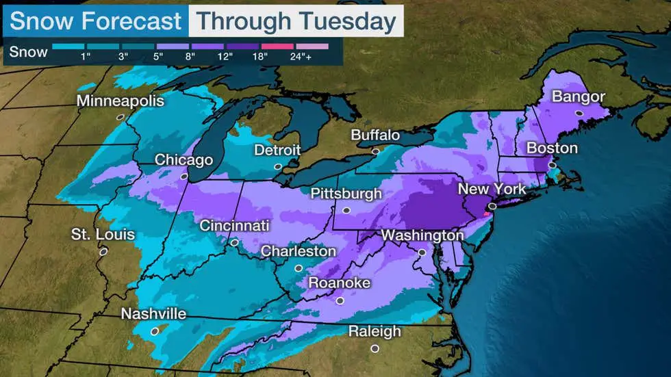
The Weather Channel Snow Map
The Weather Channel paints with a very broad brush on its forecast for this big snowstorm. The folks down there have us in the 12-18 inch range … us and about 12 million other people.
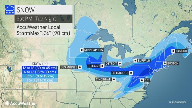
Accuweather Snow Prediction Map
Over at Accuweather, forecasters there have a narrower band of people getting between a foot and 18 inches of snow, but again, Schuylkill County definitely appears to be in that darkest blue shade.
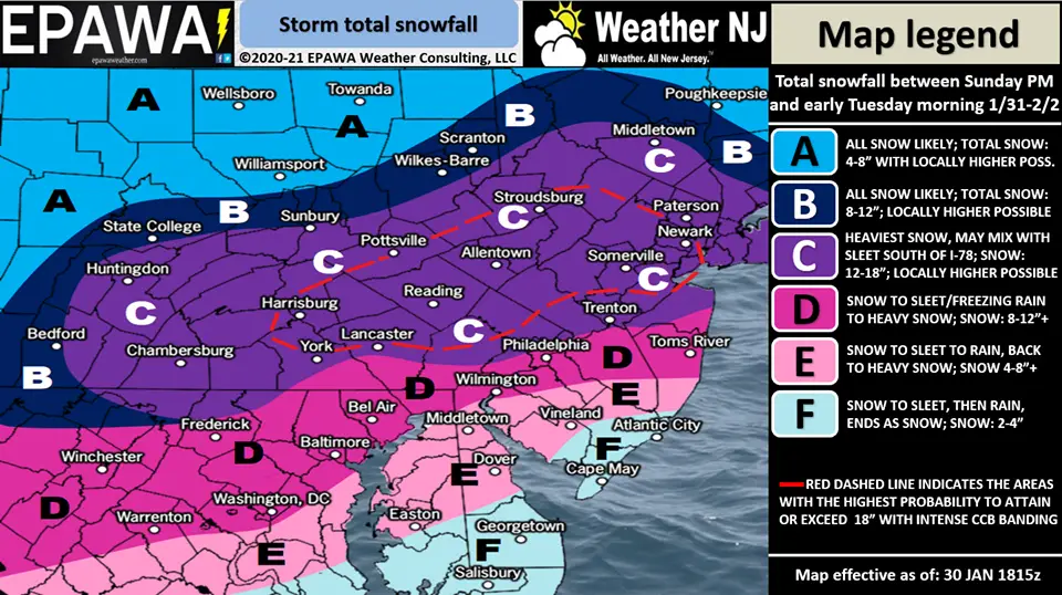
EPAWA Snow Prediction Map
The folks at EPAWA – which gets its maps shared virally on Facebook and elsewhere – has that 12-18 inch range encompassing Schuylkill County. Inside that red dashed shape that practically slices Schuylkill County in half, however, they’re predicting locally heavier amounts. So, our readers in southern portions of the coal region may see even more snow than that!
PA Weather Action Snow Totals Map
Those craving that granular level of data will enjoy the map from PA Weather Action. This shows all of Schuylkill County getting nearly 16 inches of snow from this major storm bearing down on the region.

Subscribe to Coal Region Canary
Get email updates from Coal Region Canary by becoming a subscriber today. Just enter your email address below to get started!Support Coal Region Canary
Like our reporting and want to support truly local news in Schuylkill County? Your small donations help. For as little as $5, your contribution will allow us to cover more news that directly affects you. Consider donating today by hitting the big yellow button below ...


