


That infamous rain-snow line that’s always a factor with a winter storm appears it may split Schuylkill County right in half.
According to several forecasts, that line may result in considerably more snow accumulations for northern Schuylkill County and more rain in the south.
At least, that’s what most of them think. But they’ll probably change their minds and give updated totals as the snow is falling or after you’ve started shoveling … the rain.
We’ve examined several forecasts for the winter storm expected to begin here Monday evening and wrap up by late Tuesday morning.
The Latest Weather Models for Schuylkill County on February 12-13
First, let’s take a look at what the two most referenced weather models are showing about this expected snow storm on Monday and Tuesday.
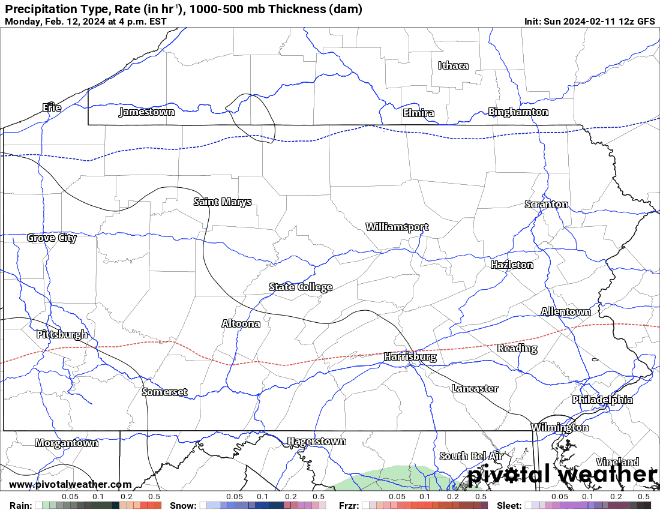
GFS Precipitation Loop
Here’s a look at what the GFS model shows regarding what type of precipitation will fall from this storm and when it’ll fall.
Note the time frame for the rain on Schuylkill County.
Euro Precipitation Loop
The Euro models shows the following with regard to precipitation type through the course of the storm.
This European model loop shows a period of rain at the beginning but definitely shows periods of heavier winter weather for us here.

Now, the big question … How much snow will fall during this storm?
We’ll show these maps from each of the two most referenced weather models but also provide a footnote that says, the numbers you’ll see on them don’t seem to match the snow accumulation totals coming from any weather news outlets.
In fact, these numbers aren’t even in the ballpark.
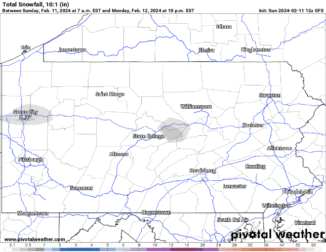
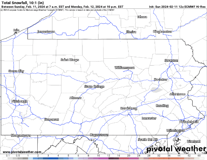
GFS Snowfall Map
Here’s the American model, which you’ll recall from above, shows a more prolonged period of rain for us here in Schuylkill County.
Euro Snowfall Map
And here’s the European model, which also has some pretty high snowfall totals. But again, none of these match any other forecast we could find, especially for central and southern Schuylkill County.
Schuylkill County Forecasts for Snowstorm on Feb. 12-13
Now, if you looked exclusively at those models and nothing else, you’d think … oh boy, better run to the store for my dehydrated emergency food supplies.
But the major weather news forecasts don’t seem to believe the numbers you see in the model loops shown above, at least not for a portion of Schuylkill County.
Actually, they don’t even agree on just how much snow will fall on Schuylkill County, as of 4:20 p.m. Sunday. At this point, you might be better off asking that tiger that predicts the Super Bowl winner.
Here’s what we found:
We checked out the forecasts for several locations in Schuylkill County and got some interesting results.
The Weather Channel
From The Weather Channel, we got some interesting results.
In Shenandoah, for instance, forecasters there are currently forecasting between 6-11 inches of snow. They’ve got the same snow total for Tamaqua and Frackville.
However, in Pottsville, from that same source, they’re predicting anywhere between 2-6 inches. The same is forecast for Pine Grove and Orwigsburg.
Accuweather
We looked at Accuweather’s own Snowfall Amount Probability forecast for the same locations. This tool shows the chances of snow total ranges. Here’s what we found:
- Pottsville: A 40% chance of 1-3 inches, a 38% chance of 3-6 inches, and a 17% chance of more than 6 inches.
- Shenandoah: A 47% chance of 2-4 inches, a 31% chance of 4-8 inches, a 10% chance of 1-2 inches, and 9% chance of more than 8 inches.
- Tamaqua: A 54% chance of 1-3 inches, a 35% chance of 3-6 inches, and a 9% chance of more than 6 inches.
- Pine Grove: A 36% chance of 1-3 inches, a 35% chance of 3-6 inches, and a 21% chance of more than 6 inches.
- Orwigsburg: A 44% chance of 1-3 inches, a 34% chance of 3-6 inches, and a 16% chance of more than 6 inches.
National Weather Service
Finally, we looked at National Weather Service for many of these same locations. Here’s what NWS is currently saying for this storm:
- Pottsville: 2-4 inches
- Shenandoah: 2-6 inches
- Tamaqua: 2-6 inches
- Pine Grove: 2-3 inches
- Orwigsburg: 2-3 inches
We’ll provided updated forecasts for this storm on Monday, when it’ll be an all rain event or a blizzard.