


We’re about 60 hours away from when many believe a snowstorm will begin impacting Schuylkill County on Saturday afternoon.
As we creep closer to that time, the weather models and popular forecasters are starting to believe they have a better idea of what will actually happen once the flakes start falling.
And as we normally do with impending snowstorms, we’re gathering as much info as we can and presenting it all to you so you have an idea and can make a decision for yourself on what will happen.
Winter Storm Expected in Schuylkill County on January 6th
Let’s take an overview of what forecasters are saying right now about the winter storm headed our way here in Schuylkill County.
- BEGINNING: After 1 p.m. on Saturday, January 6
- ENDING: Around 8 a.m. Sunday, January 7
- MORE: Snow is expected to fall through the day on Sunday but most of the accumulating snow from this system is expected to wrap up by early Sunday morning.
- TIMING: Snow will be heaviest on Saturday night, especially before 1 a.m. Sunday. That means waking up to potentially a lot of work to get your sidewalks cleared and vehicle shoveled out.
- RAIN/SNOW?: Don’t expect a rain/snow mix with this storm. The high temperature isn’t expected to rise above freezing during the day on Saturday. A low of 29 is forecast for Saturday night and a high of just 34 on Sunday, so whatever snow we get won’t melt right away.
Latest Weather Models for the January 6th Snowstorm in Schuylkill County
Earlier this week, we glanced at some of the more popular weather models to show they were indicating a potential big storm was afoot. We urged everyone not to look at the snowfall totals because, especially that far away from the start of the storm, they’re never accurate.
Now that we’re close to 2 days away, we can start to look at the storm totals. But we’ll also pay attention to where these models have the bulk of the storm headed, either a direct hit on Schuylkill County or off to the north or south.
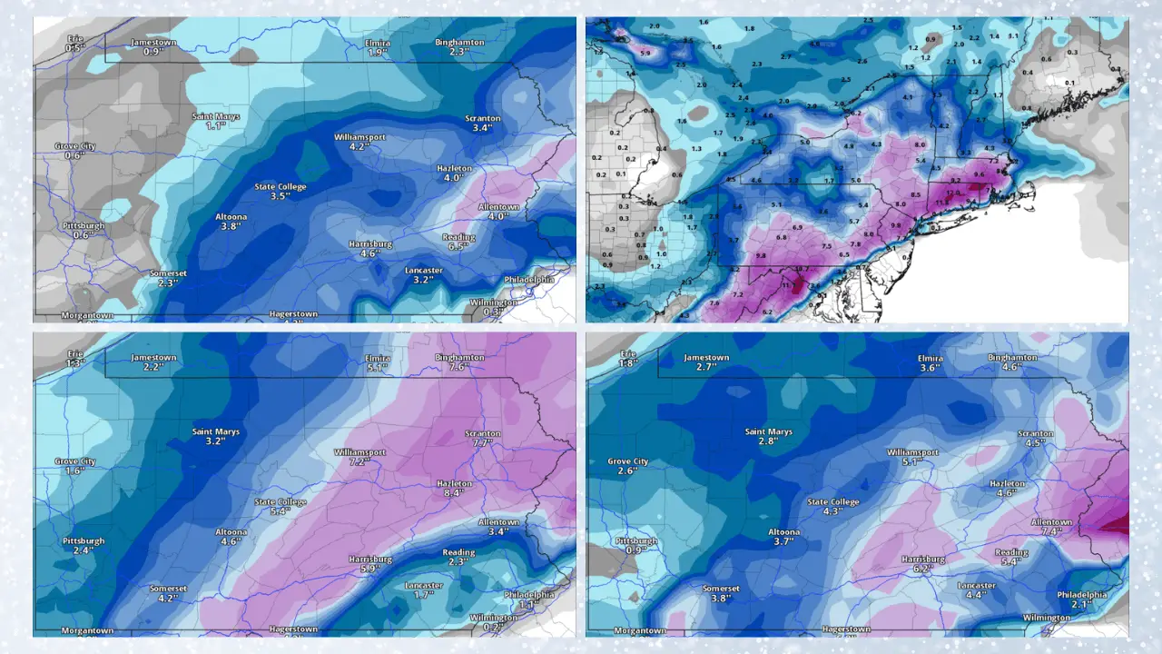
Let’s have a look at the latest weather model runs. We’re going with 4 of the most popular models: GFS, Euro (ECMWF), NAM, and Canadian (GDPS). The storm totals shown on these maps are through some point on Sunday. In a few cases, we had to share the latest available time the model allows.
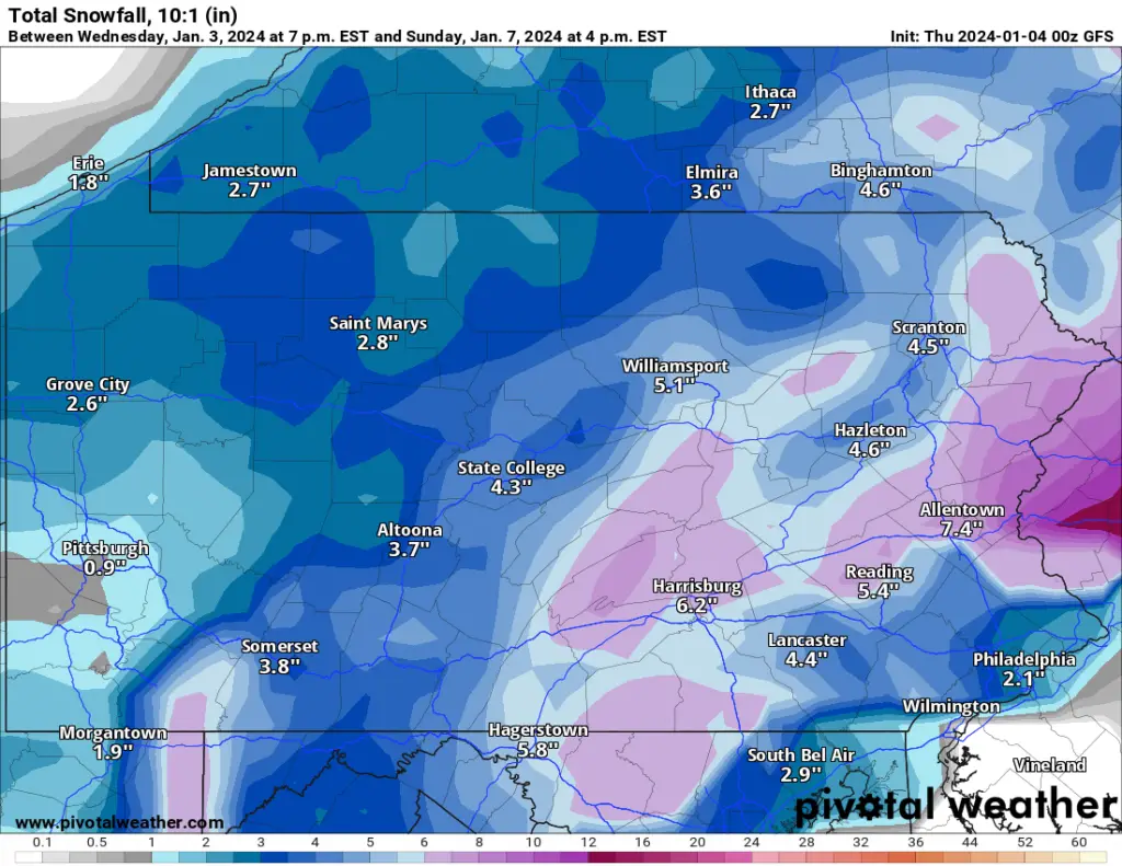
GFS – Thursday 00z (Wednesday 7 p.m.)
The GFS model run from Wednesday at 7 p.m. shows a bit of a scattered blast of the heaviest snow from this storm on Saturday.
Some of it falls on a portion of Schuylkill County, especially for our readers in the south and east. Those areas, if the GFS is accurate, could see about 7 inches of snow from this storm. Lesser amounts, like 4 inches, would fall on the extreme north of Schuylkill County. For folks in Pottsville and western Schuylkill County, they’re looking at something in the middle, like 5-6 inches.
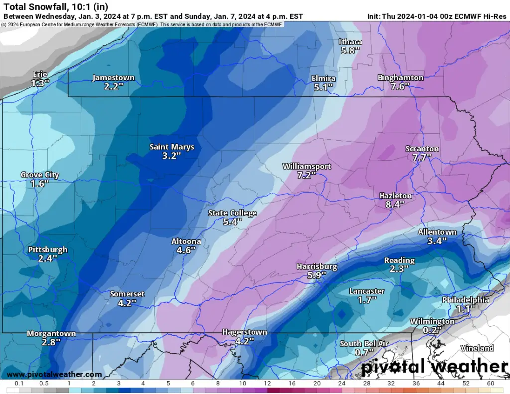
Euro – Thursday 00z (Wednesday 7 p.m.)
The Euro model run from Wednesday night is the one snow lovers in Schuylkill County will want to believe more than others. It has the storm making a direct hit on the area. And it tracks the heaviest snow from the storm more northerly than the others.
If this model run proves accurate to events as they happen on Saturday, northern Schuylkill County could see 7-8 inches of snow. The Pottsville area and anywhere in a stripe straight across Schuylkill County could see 6-7 inches.
A few less inches would fall on southern Schuylkill County’s border, if the Euro is accurate.
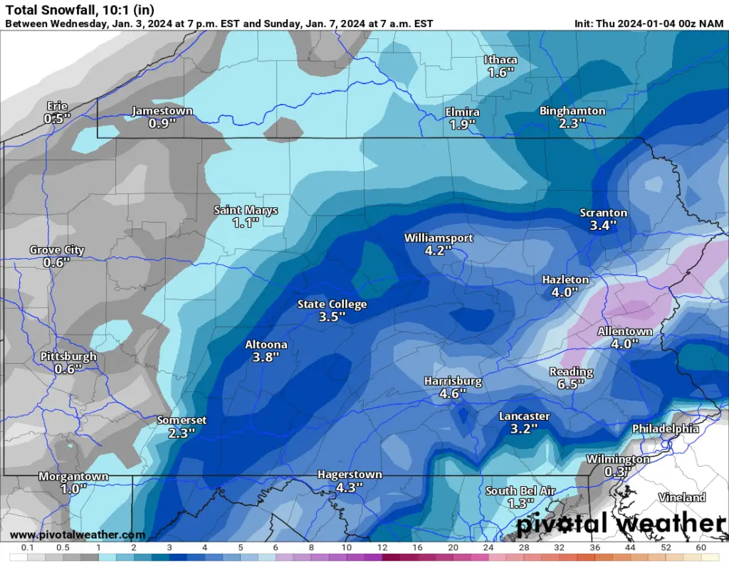
NAM – Thursday 00z (Wednesday 7 p.m.)
This NAM run is definitely the most conservative when it comes to snow totals.
Just a small portion of Schuylkill County would get anything more than 5 inches, if it proves to be accurate.
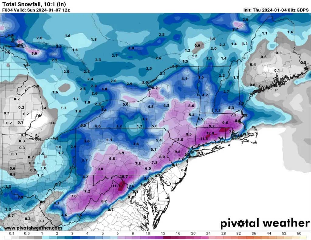
Canadian – Thursday 00z (Wednesday 7 p.m.)
The Canadian model shows a definitely southerly track for the heaviest snow but much of that heavy snow wouldn’t fall on Schuylkill County, if this is correct.
What Others Are Saying About the January 6th Snowstorm
We’re going to take a look at what some of the more popular weather forecasters are predicting right now for the expected snowstorm on Jan. 6-7.
Just like the weather model images shown here, you can bank on these changing between now and you even finishing this article. It’s always important to keep that in mind.
National Weather Service: NWS is crediting the Euro model with being the most consistent this week with regard to the storm track and accumulation totals. That’s why they seem to be backing the Euro’s forecast.
Right now, NWS predicts between 4-8 inches of snow for Schuylkill County.
Accuweather: Accuweather’s Wintercast tool shows the Pottsville area receiving 4-8 inches of snow from this impending storm. It’s got the same for Shenandoah and Tamaqua but only 3-6 inches for Pine Grove and Orwigsburg.
The Weather Channel: Much of the same is being predicted by The Weather Channel right now, too. They’re also of the belief that 4-8 inches of snow is possible in Pottsville and much of Schuylkill County on Saturday and Saturday night.
Again, it’s important to remember that even a little more than 2 days from the start of the storm, these numbers are likely to change drastically between now and then.
Bob Beruck
January 4, 2024 at 3:59 am
Thanks for all of your hard work. The Canary rocks!