


Snow lovers in Schuylkill County have been iced the last couple years. But that could finally change this weekend.
The leading weather models have been in agreement for a couple days now on the possibility of a big storm headed our way this weekend, January 6 and 7.
Obviously, it’s far too early to predict how much snow could fall or when it might start. It’s probably a little too early to suggest that this potential storm could happen.
However, the models right now – as of our last check (the Tuesday 00z update/Monday 7 p.m.) – continue to be in agreement that something is likely to happen.
Weather forecasts from some of the leading sources tend to agree and have started mentioning it in their 7-day forecasts.
So, let’s take a look at the probably way-too-early snowstorm forecasts and weather models to get an idea of what might happen this weekend.
Weather Models in Agreement on Something Big and Snowy Happening This Weekend
We looked at the latest runs of the ECMWF (aka the Euro) and the GFS models to see what they’ve been indicating for more than a day.
For the record, what these models are showing now is basically what they’ve shown for the last 36 hours or more, with some slight deviations from run to run.
As an example, in a previous run on Monday, one of the models had this potential storm tracking more south of the coal region, meaning the possibility of a big snow was not as likely.
That could happen again and it could be what happens this weekend. Again, anything at this point could happen.
But a big snowstorm hasn’t happened here in what feels like a decade, so we’re letting loose with some early talk about it.
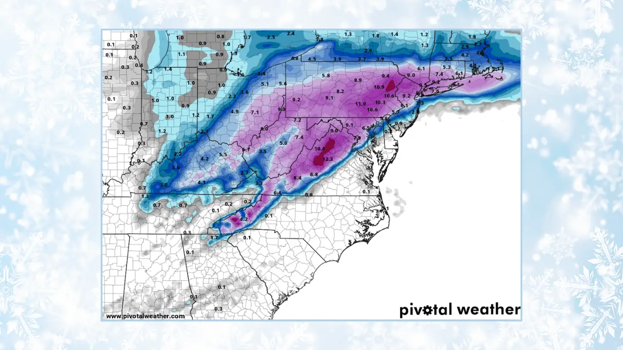
Let’s have a look at the Euro model’s run from Monday evening. This is the latest available at Pivotal Weather as we published this post.
Try to ignore the numbers on the map. From our history of tracking weather models, numbers like this so far away from the potential start of a snowstorm are often very inaccurate.
What you can glean from this image is the possibility of something big and snowy happening here. From what we’re seeing, the storm would start Saturday afternoon and continue through the early part of the day on Sunday.
The heaviest of whatever happens would be on Saturday night and just after midnight on Sunday.

The GFS model shows pretty much the same thing.
A slight difference of note here is the worst of whatever happens tracking further to the south and to our west.
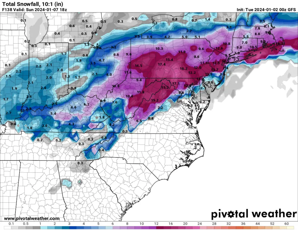
But, for the most part, these model images are very closely aligned.
Forecasts Point to Snowstorm on Jan. 6-7 in Schuylkill County
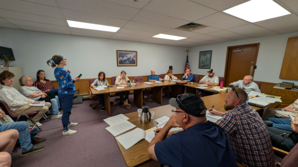
It’s not just our amateur set of eyes that believes it.
The weather forecast data from National Weather Service we use for our daily weather updates tend to agree with what the models are showing, even if it’s 5 days away.
NWS has Schuylkill County getting snow starting Saturday afternoon and continuing into Sunday. No accumulations are being given, not this far away from the possible start date.
Accuweather is indicating snow as a possibility both Saturday and Sunday, too, but is shying away from giving any predictions on accumulations. A report there does warn of a potential disruptive snowfall for the Mid Atlantic region, however.
The Weather Channel is doing the same, forecasting snow mostly on Saturday and a little more on Sunday. Right now, they’re predicting in the 5-8 inches range but you can put money on that changing drastically between now and then.
Stay with The Canary
Coal Region Canary will continue to provide updates on the latest forecasts and weather models in the days leading up to this potential snowstorm in Schuylkill County.
If it does snow, be sure to send us photos we can share with our readers here on the site and on our social media channels. Use this simple form to upload images right to us …