It’s looking like a lot of people in Schuylkill County are going to be eating French Toast on Wednesday. You may want to buy enough for breakfast on Thursday, too.
The forecast for the big snowstorm on Wednesday is largely unchanged 24 hours after we first reported on the initial forecasts for it.
Let's take a live look at northeast U.S. meteorologists looking at this evening models for the upcoming winter storm Wed-Thu. pic.twitter.com/TAfnbAXG4y
— Morgan Palmer (@MorganKIRO7) December 14, 2020
Keep scrolling to see how much snow is going to fall in Schuylkill County, according to the top meteorology teams and other leading forecasters:
Big Snowstorm Still Predicted for Schuylkill County Wednesday
It’s looking more likely that we’ll get a significant amount of snow in the coal region on Wednesday but the exact path of the storm is still … uhhh, up in the air.
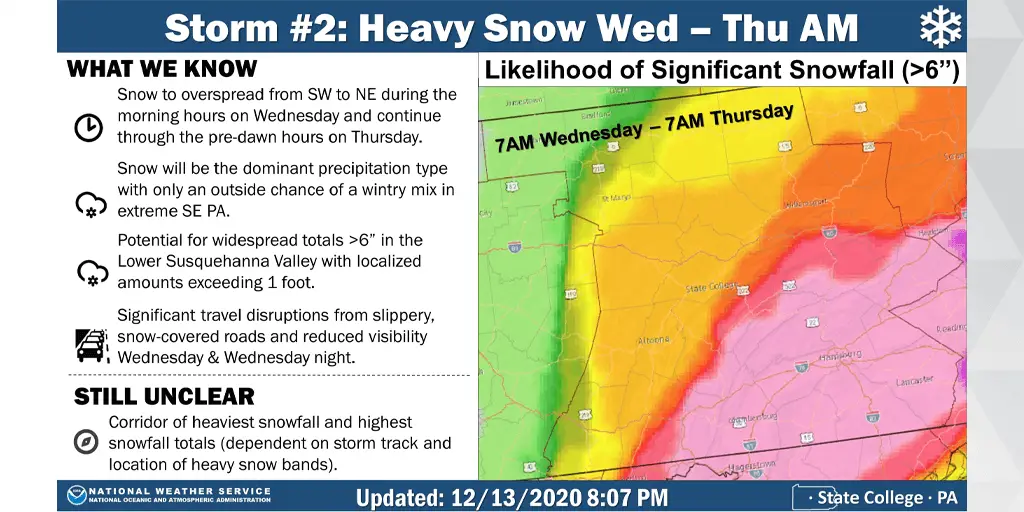
The folks at National Weather Service believe the chances are really good that we’ll get more than 6 inches of snow from the big storm on Wednesday.
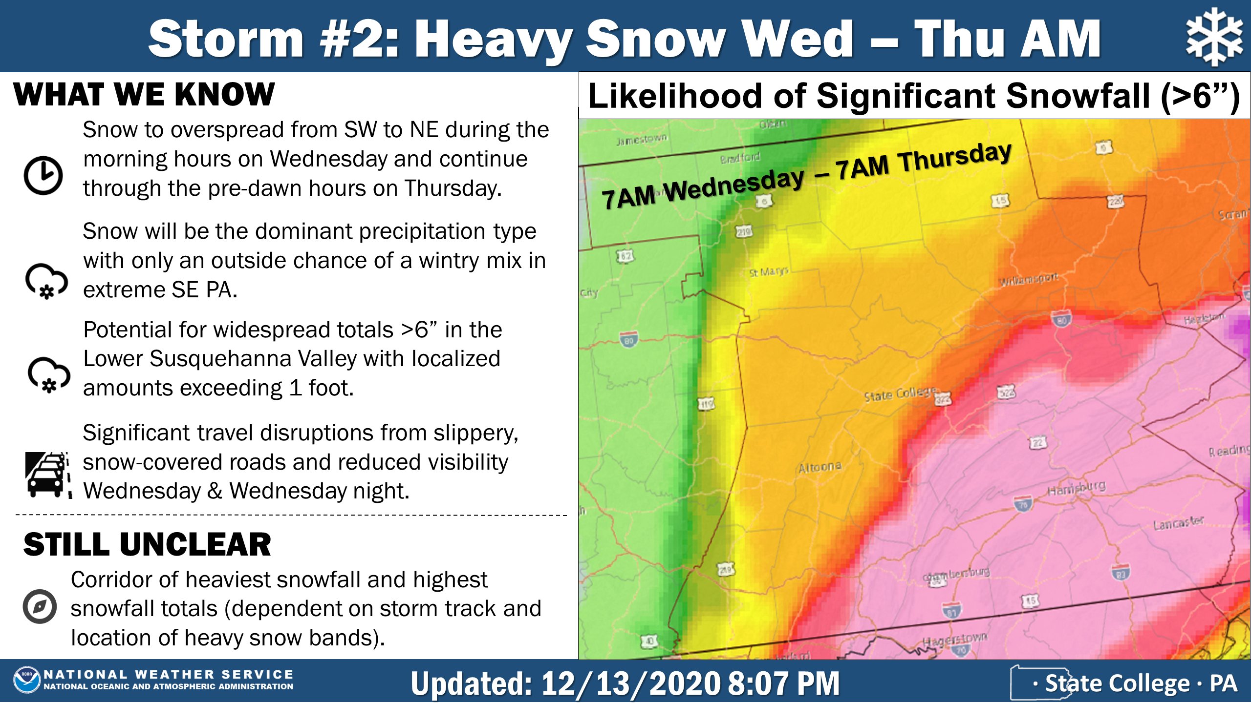
Here’s a map they whipped together on Sunday to show where they believe it’s most likely to snow more than 6 inches.
Though there’s no key to tell us what the colors mean on the map below, we’re presuming that he deeper purple color has the greatest chance of getting more than a half foot of snow. Nearly all of Schuylkill County is shaded in pink, which presumably has a pretty good chance of getting a lot of snow.
NWS also says that where the most snow will fall hasn’t been determined just yet.
Accuweather Predicts 10-15 Inches of Snow
Accuweather’s pick for between 10-15 inches of snow remains unchanged from Saturday night.
The latest forecast believes the storm on Wednesday will drop close to or just more than a foot of snow on Schuylkill County.
They’re also forecasting a 5% chance of thundersnow!
The Weather Channel Holds Steady
The Weather Channel is still predicting anywhere between 8-13 inches of snow for Schuylkill County, specifically Pottsville, for Wednesday’s big storm.
Snow will get heavier as the day goes on before tapering off early Thursday morning.
GFS Model
The first GFS model run on Monday showed the storm dropping a little less snow than the forecasters are suggesting might happen on Wednesday.
You can see in the animation in the tweet below, the heaviest snow falls just south of Schuylkill County.
0z GFS pic.twitter.com/AymTrWKnHC
— 🇺🇸 My Health My Choice Patriot 🇺🇸 (@NJSnowPatriot) December 14, 2020
Euro Model
If you like snow, you may want to go with the Euro weather model. The latest run before we went to press with this shows significantly higher accumulation totals, like 2 feet instead of just 1 foot.
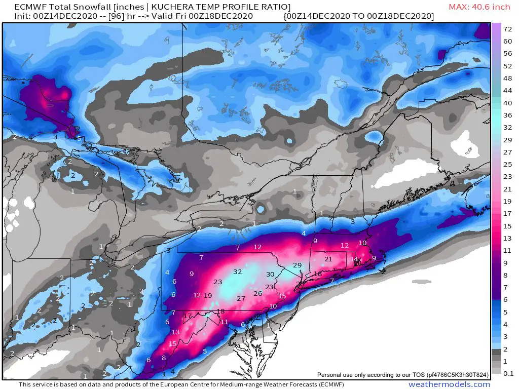
We’ll keep following the forecasts on this storm as they get a little more refined.
Subscribe to Coal Region Canary
Get email updates from Coal Region Canary by becoming a subscriber today. Just enter your email address below to get started!Support Coal Region Canary
Like our reporting and want to support truly local news in Schuylkill County? Your small donations help. For as little as $5, your contribution will allow us to cover more news that directly affects you. Consider donating today by hitting the big yellow button below ...


