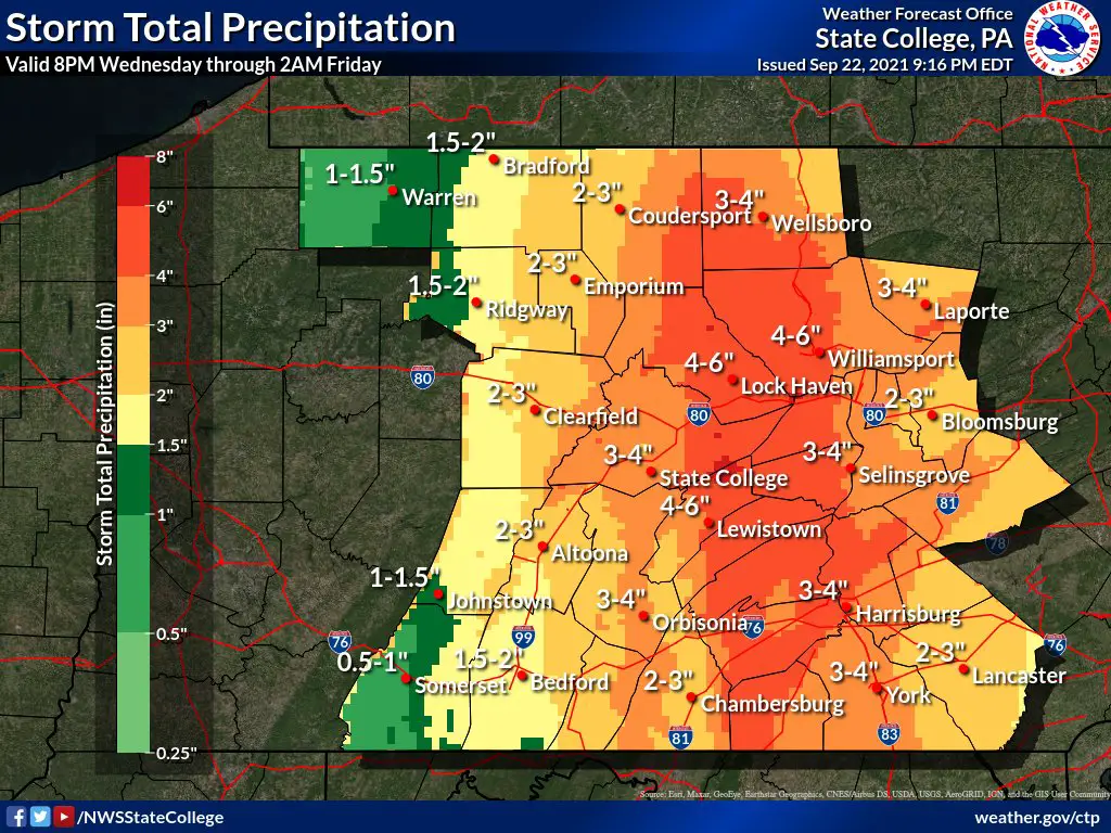
Between 2-4 inches of rain is expected to fall on Schuylkill County Thursday and National Weather Service has issued a Flash Flood Watch for the area.
The Flash Flood Watch is in effect locally from 4 a.m. until 1 a.m. Friday. In addition to Schuylkill County, the Flash Flood Watch applies to the following counties in Pennsylvania: Adams, Columbia, Cumberland, Dauphin, Juniata, Lancaster, Lebanon, Montour, Northern Lycoming, Northumberland, Perry, Schuylkill, Snyder, Southern Lycoming, Sullivan, Tioga, Union, and York.
Heavy rain is expected to move slowly across Pennsylvania through the overnight hours, according to National Weather Service forecasters.
The heaviest rain is likely to fall west of Interstate 81 but as much as 4 inches could fall on Schuylkill County on Thursday, alone. That could spell trouble for some areas of the region already hit by heavy rains several times this summer, including most recently with the remnants of Hurricane Ida.
Mid-morning through the afternoon hours is when the rain is likely to be at its heaviest over Schuylkill County but forecasters suggest the timing of that could change overnight and through the early part of the day on Thursday.
In addition to heavy rain, there is a chance of strong, damaging winds. That could help bring down power lines across the coal region and cut electricity to many.
READ MORE:
Subscribe to Coal Region Canary
Get email updates from Coal Region Canary by becoming a subscriber today. Just enter your email address below to get started!Support Coal Region Canary
Like our reporting and want to support truly local news in Schuylkill County? Your small donations help. For as little as $5, your contribution will allow us to cover more news that directly affects you. Consider donating today by hitting the big yellow button below ...


